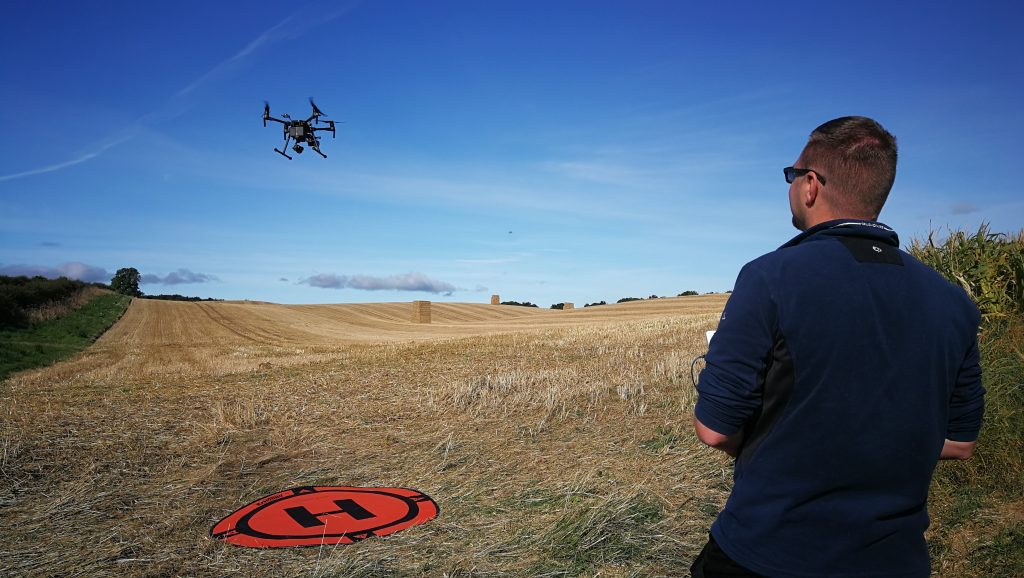
We offer drone surveying and aerial imaging as a service for research trials, crop breeding and agricultural projects. Our RGB, multispectral, thermal and LiDAR surveys help turn a field-wide view into measurements that can be compared between plots and through the growing season.
Contact us to discuss a drone survey — tell us about your site, crop, survey area, timing and the questions you want to answer.
Imaging capabilities
RGB imaging
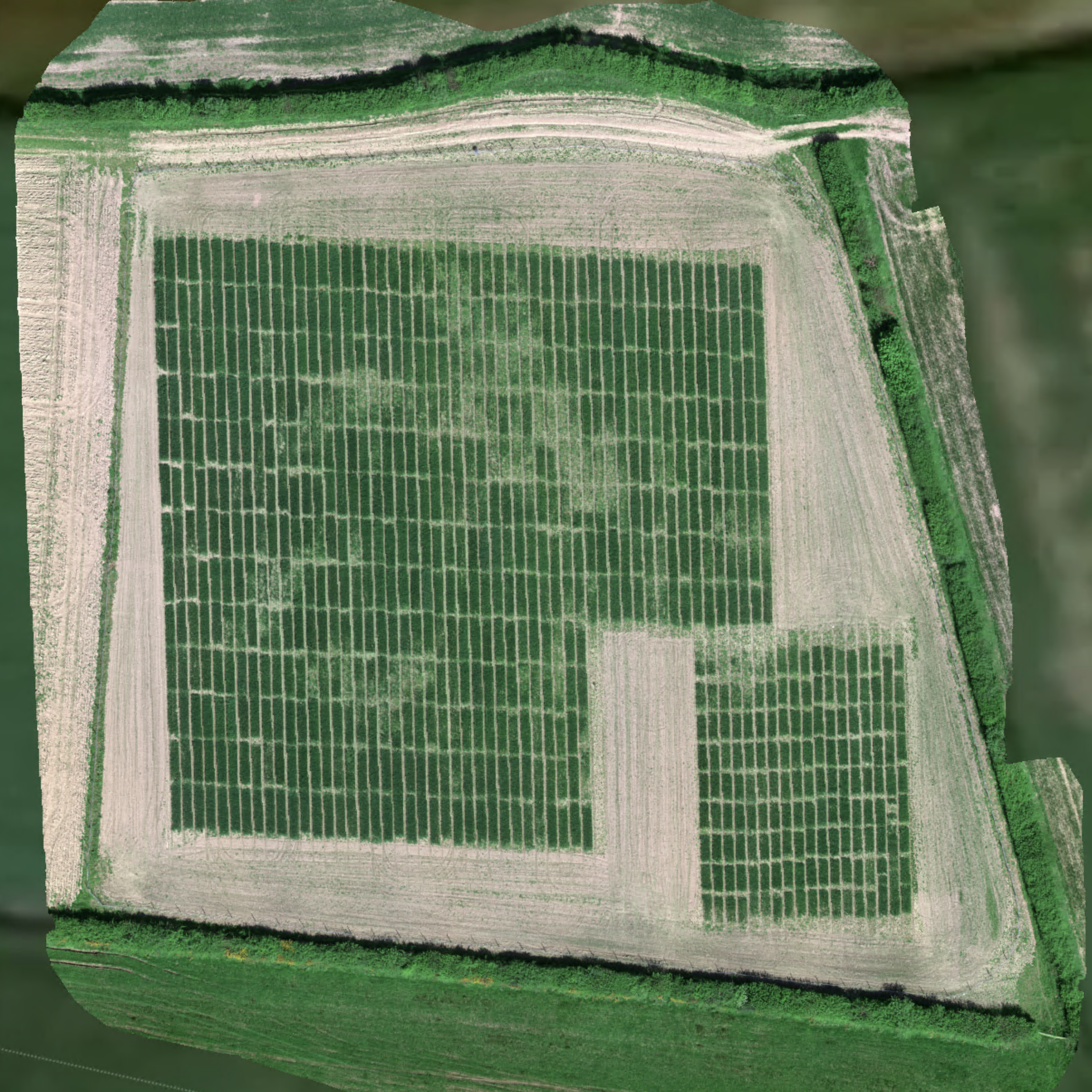
High-resolution visible-light imagery records field and crop condition. Images can be combined into an orthomosaic: a detailed aerial map used to inspect trial layouts, establishment, canopy cover and visible changes such as lodging.
Multispectral imaging
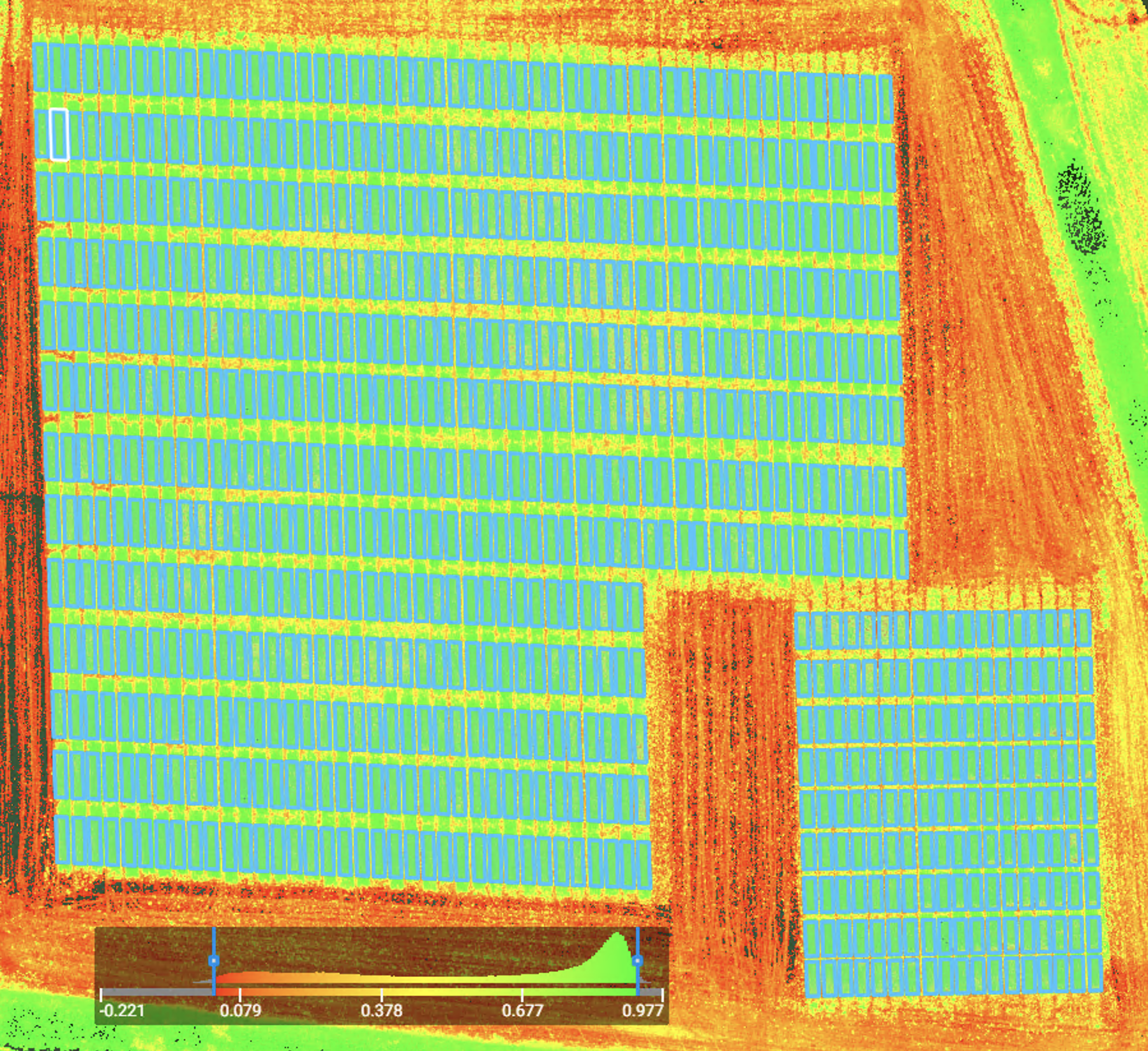
Multispectral imagery includes information beyond visible colour, including near-infrared reflectance. Vegetation indices help describe variation in canopy development and crop condition across a field. Plot boundaries can be overlaid to extract measurements for individual breeding lines or treatments.
These measurements guide further investigation alongside field observations, sampling and environmental records.
Thermal imaging
Thermal surveys map surface temperature differences across crops and their surroundings. Used alongside field measurements and weather records, they can support investigations of canopy temperature and crop responses to water availability.
LiDAR
LiDAR surveys provide three-dimensional information about vegetation and terrain. These data can support structural measurements, terrain modelling and habitat mapping, with the survey and analysis tailored to the project.


From flight to useful data
- Plan: agree the research question, site, timing and suitable imaging approach.
- Survey: collect aerial imagery, with repeat visits where seasonal monitoring is needed.
- Map and analyse: produce field maps and, where agreed, vegetation-index maps and plot-level measurements.
- Interpret: relate the imagery to trial records and ground measurements to support research or management decisions.
The survey schedule and outputs are agreed for each project.
Supporting crop breeding
Breeders assess thousands of plants and plots for yield, quality, resilience and agronomic performance. Repeated drone surveys provide a consistent record of how those plots develop, complementing essential ground-based scoring.
Oats: following performance through the season
At IBERS, oat breeding trials are surveyed roughly every fortnight during the growing season. The imagery helps track establishment, canopy development, greenness, vigour and visible stress or lodging. Comparing surveys over time helps breeders identify unusual plots and decide where to focus detailed field checks.
Combining plot measurements with trial records helps distinguish the performance of a breeding line from the effects of local field conditions. Drone data supports the breeder’s judgement when deciding which lines progress.
Drones in modern farming
Aerial mapping can help farmers see variation that is difficult to assess from the ground. Applications include checking crop establishment, identifying areas for closer inspection, monitoring grass growth and informing management zones. When combined with soil information, sampling and agronomic advice, these maps can also inform prescription maps for targeted applications by suitable equipment.
Maesnewydd: exploring grass measurement from the air
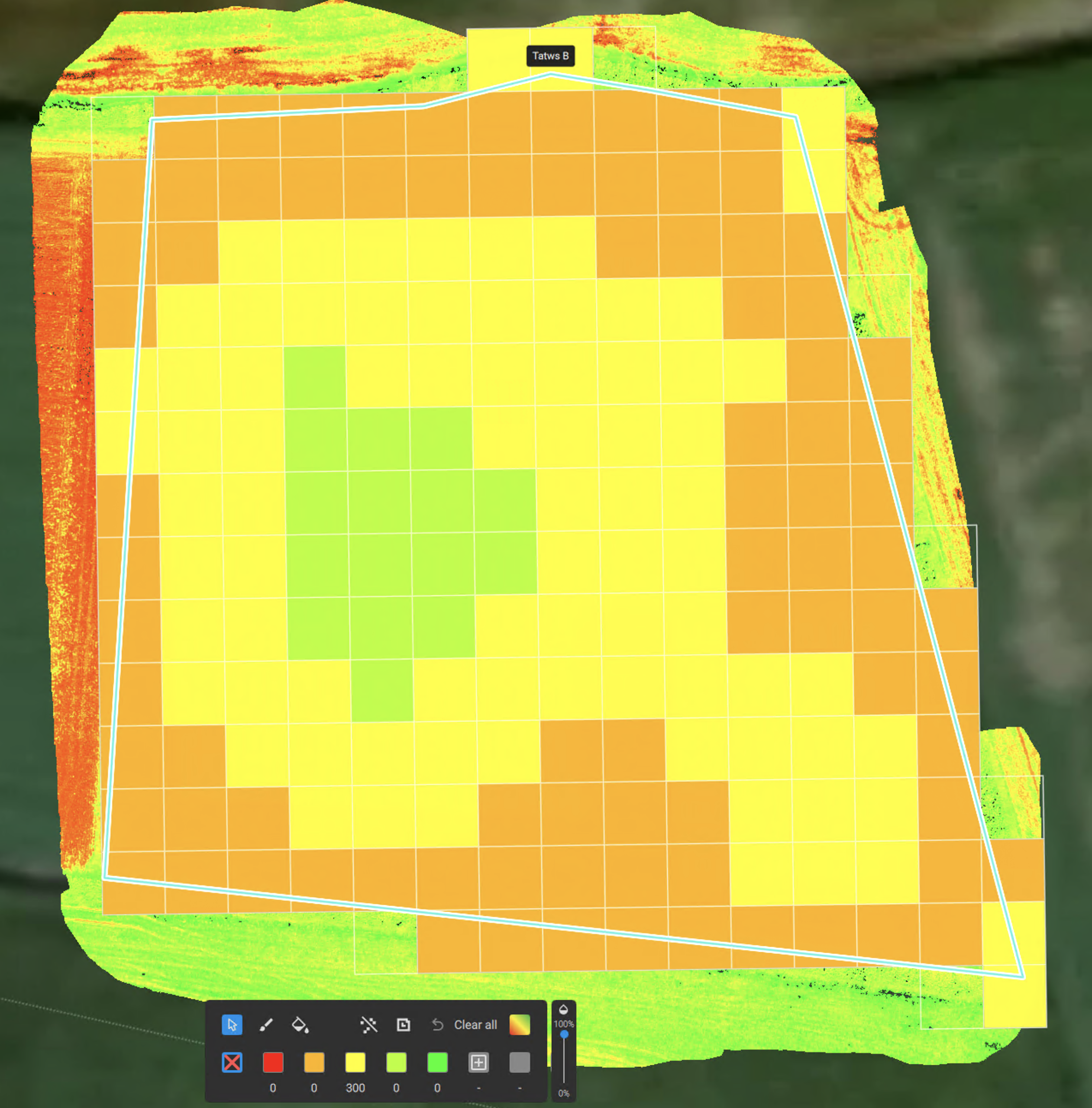
Supported by the Farming Connect Try-out Fund, IBERS investigated drone-based grass measurement over a 20-hectare grazing block. RGB and multispectral imagery was paired with plate-meter measurements, grass samples, laboratory analysis and Brix readings.
The project tracked growth, grazing and regrowth, and developed a working model to estimate grass cover at the study farm. Multispectral imagery gave the strongest results, with RGB imagery also showing promise. Applying the approach elsewhere requires further calibration and validation. Predicting feed quality is a future research aim.
Discuss your project
We welcome enquiries about one-off surveys, repeated trial monitoring and collaborative research. Get in touch to discuss the imaging, analysis and outputs suitable for your project.
Aerial survey gallery